Wednesday, September 30

Olympic National Park


Have now been back from my trip up north a little over a week and have already loaded back up and spent a couple more nights in the camper.  Petey and I love being out in the woods just roaming around. Tiffany and Max were on a college viewing tour to San Diego and Denver so I figured since the weather was almost perfect I'd do a little exploring over in the Olympic National Park.  I've still got lots of catching up to do on future posts from my trip up north to Alaska and plan to get to them soon.  Figured I'd go ahead and post up this little excursion while it's fresh.  I had read about a road off of Hurrican Ridge called Obstruction Point Road so I wanted to check it and do a little hiking up top.  Had been told that it's a real sketchy road and can be dangerous.  A huge exaggeration in my opinion. Funny how anything the government has control over they tend to inflate the potential danger.  Try Lippincott Road in Death Valley if you want something that can give you a little "pucker factor" depending on the conditions.  Tiffany and I did it this past spring pulling a trailer and the "pucker factor" was going strong.  Click on the following link for the trip to Death Valley.  Obstruction Point road has beautiful views but as far as being dangerous.....it's not! Perhaps if one is an idiot, vehicle has no brakes, driving drunk, blind, etc., etc., I'd say it's a road to pay attention to, nothing more. I drove in taking my time and actually survived! The road dead ends up top around 5500 feet and offers a great view of the Olympic Range. Here one has a selection of trails which access the surrounding ridgelines or drop rapidly down to a couple of valleys. I got up top around 2:00 in the afternoon and after letting Petey chase (he never catches anything) Marmots for over an hour, then decided to go for about a 4-mile hike along the ridgeline.  When I got back there were no other cars to be seen, the weather was perfect, a beautiful sunset was starting to unfold and I had beer in the cooler, sardines and crackers, so I decided to spend the night right where I was parked. Not an official campsite but didn't figure anyone would come along since it's an eight-mile drive from pavement to get here.  I knew there would be a full moon and there wasn't a cloud in the sky or a breath of wind.  Figured it would be worth it to stay put for the night even if the temps would probably drop somewhat considering I had gained a little altitude coming in.  The temps got down around 40 but we were toasty in the bag. A beautiful night and I had it all to myself.  When I finally rolled off the following morning at 9:30 I still hadn't seen anyone.

Hike along the ridgeline towards Grand Pass

Camp for the night

Full moon was really something. When I got up the following morning it was still high and easily visible.  I don't think I've seen the moon stay up this long once the sun came up.  I was up at daybreak and watched the sun come up in the east while the moon was still prominent in the west.  Got this shot about 8:00 am that morning.


Let Petey do his thing for another hour and then loaded up and headed to the Sol Duc area of the park.

 Petey on the hunt.....but capturing nothing!

The drive to Sol Duc is another nice drive which takes you along Crescent Lake.  A hike in from the Storm King Ranger Station takes you to some old growth forest and the Marymere Falls.

 Some old growth

 Selfie at Marymere Falls

Spent the rest of the day just kinda doing nothing.  Couple of short hikes and some pull overs next to the Sol Duc River for some shots.  There is a hot springs on the Sol Duc road but it's pretty commercialized and expensive.  Rather than make the springs somewhat natural they've put in a swimming pool.  Shame because it's a beautiful setting.  I've been in it once many years ago but haven't been back since.  Probably never go again.


Fall colors along the Sol Duc River

Stayed up in the Sol Duc area until dark and decided to drive back to Port Angeles for the night where I got another free campsite.  Wal-Mart parking lot!  Was just trying to shave some time off the drive home and Wal-Mart was calling.  I'll bet there were another 30 rigs in the lot.  Some I talked with were waiting to catch the ferry over to Vancouver Island the following day.  I wonder what Wal-Mart makes in sales off of RV'ers since they allow them to stay over for free.  I know they ended up with some of my money.

Will be continuing with the Alaska/British Colombia posts soon.  Stay tuned!

Friday, September 25

Crossing into Alaska

Homemade houseboat on the Yukon River

Now that I'm back in the real world I'll try and get caught up on the trip.  My last post had Petey and I spending our last week on the Dempster in the Yukon.  I could have easily spent another week or two in this area alone but needed to keep heading west and south towards Alaska.  Having been up north of the Arctic Circle we'd had some snow and cold temps so were anxious to get a little further south.  Petey does not do cold well and I'm not a big fan either.  After getting off the Dempster, I headed back into Dawson City to wash the rig and gas up before catching the free ferry across the Yukon River to access the Top of the World Highway.  Another dirt/gravel road that offers some great scenery.  I also wanted to take the side road which takes you up to the village of Eagle, Ak.  Upon arriving in Dawson City, they were having the annual Outhouse Races so of course I had to stop and see that. I had met a girl on the Dempster that had been travelling and living on the road solo for the past year. I'm taking some pictures and noted she was in the race.  Talked with her later and she said she was just walking down the street and one of the teams needed a member and asked her to race. Heard from her via email later that she ended up making some new friends and stayed in Dawson City longer than planned.  Since I had been in Dawson City the previous summer there wasn't really much I wanted to see so after taking care of some business I caught the ferry and camped just across the river.

Outhouse race in Dawson City


Cheering section for one of the teams

Dawson City is a unique spot in the Yukon.  Once the center of the Klondike Gold Rush back in the late 1890's.  It has now parlayed that history and its unique character into a tourist spot during the summer months.  Town has no paved streets, wooden sidewalks, no stop lights, its fair share of tourist shops and a thriving community feel to it.  Without the tourist trade during the summer months though I'm not sure how it would fare.  You have to come through it to get to the Top of the World and to cross back over into Alaska so you'll visit it whether you want to or not if coming this way.
Dawson City along the Yukon River

Downtown Dawson City

An area worth exploring from the campground is the old steam wheeler graveyard which is an easy hike downstream along the shore of the Yukon River. It's a spot where some of the old steam wheelers were scuttled after they'd reached their end of service.  Fun spot to crawl around and view some history.


Current "tourist" paddle boat which hauls passengers out on the Yukon from Dawson City

Following morning it was over the top with a side trip into Eagle, Alaska.  Born out of the Klondike Gold Rush it was a stopover spot for the steam wheelers. Eagle became a supply and trading center for miners working the upper Yukon River and its tributaries back in the late 1800's.  It is also a checkpoint for the Iditarod Dogsled Race held annually up here.  Another spot that is worth making the effort to get to. Nice BLM campground just outside of town.  Road coming in here was fairly beat up when I came in due to some recent rain which turned it into a mud bath but could be done in just about any vehicle when dry.


Backtracked the following morning back to the Top of the World and headed to Chicken, Alaska.  Another old mining town with a year-round population of about 20.  No power to the town so the two businesses run diesel generators for power.  Susan, who owns the bar and cafe offers free camping next to her place.  Only problem is the camping spots are located near the generators and they run until the bar closes down at night.  Night I camped, the revelers were out in full force and the generator didn't get shut off till 3:00 am.  You take your chances! Short video of Chicken pilfered from YouTube. Video of Chicken, Alaska

Border crossing back into Alaska

Downtown Chicken, Alaska

 Sweet rolls as big as your head!  Yes, they're good.

 Bar in Chicken

Some art work in Chicken

Headed to Denali National Park from here!


Thursday, September 24

Headed to the Dempster

View from camp in Tombstone Park on the Dempster. A dusting of snow the previous night.......mid August.

After doing the South and North Canol roads in the Yukon I headed over to Faro and the old town of Keno. Both old mining towns. Keno is an interesting place and another one of those towns where you have to drive in on bad roads. When the road ends, after about 60 miles, you've made it to Keno.  Weather was really bad while there so I didn't do much other than walk around checking out the area, camped for the night and left the following morning heading to Dawson City to resupply before going up the Dempster.  A drive up to a ridgeline supposedly offered an amazing view of the area but we were socked in due to low clouds so I skipped trying to get up there.  Will give me a reason to come back!

One of two dining establishments in Keno.  Excellent pizza if you can catch him open.  He doesn't really have set hours.  Says he's open when the mood strikes him.

Some mining equipment on the road in

 Perfect set up for the bachelor in Faro.

I had done part of the Dempster last year when I rode up on the bike Chores are done - I'm going to Alaska but this time I wanted to get to the Arctic Circle and hopefully up to the Richardson Mountain Range in the Northwest Territories. Another highlight of the Dempster is the Tombstone Provincial Park which is located about 80 miles in.  A beautiful park that is true wilderness.  One road goes through it with one small visitor center.  If you want to see anything else, you hike.  No tourist shops selling crap t-shirts, trinkets, postcards, ice cream, etc., etc..  It's a great area because of this and its remoteness.  It isn't overrun with tourist......yet. A must do if ever up this way. Most people driving the Dempster go all the way into Inuvik to say they drove to the end of the road. Not being one to care much about punching that ticket I opted to spend more time in the more remote areas for possible wildlife viewing. I ended up spending a week on the Dempster just poking along, camping in great spots, fishing and viewing lots of wildlife.  The Dempster begins about 20 miles outside of Dawson City and ends in Inuvik 450 miles later.  It's an all dirt/gravel road which is fairly maintained and can be driven by passenger vehicles most of the time.  When it gets wet is where the fun begins.  It can quickly turn into a mud fest after a few hours of rain.  I only had about a full day of muck and mud and it was a mess. Was told that when it gets really bad vehicles other than four-wheel drive have to simply wait for it to dry out before proceeding.  There are worse places to be stranded due to rain.

Wildlife viewing along this corridor is excellent.  I even saw two large black wolves but didn't have the camera ready and failed to get a shot.

 Caribou


 Grizzly

 Musk Ox

Black bear with cub

 More Grizzly

Beaver

Ptarmigan


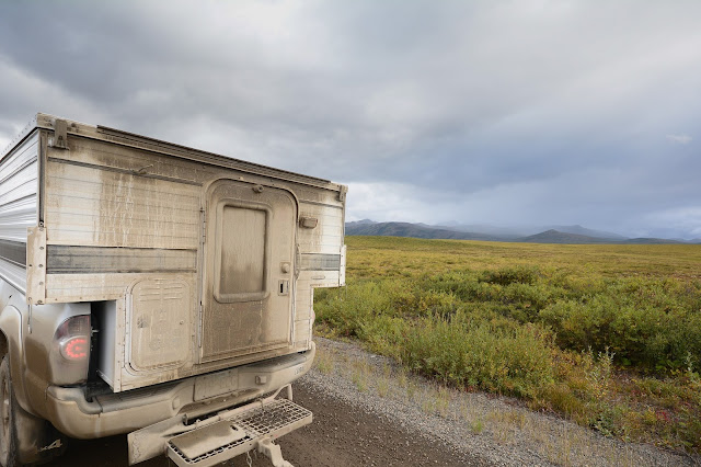
With just a little moisture, everything gets covered in mud.

Fine dining on the Dempster

Petey checking out a bicyclist who was riding the Dempster. A major commitment!

Petey and I finally made it to the Arctic Circle and points north.


 Not a bad campsite.  North of the Arctic Circle.

 Views are never ending


Had a great time driving the Dempster and would highly recommend doing it.