

Months, if not years, could be spent roaming around between Williams Lake and Bella Coola in British Columbia. The area in between makes up the Chilcotin Plateau which could keep one busy for many months without ever getting to the end of the road. Having been to this area before I knew I'd be going back after my last visit a few years ago. It's an outdoor mecca with scenic views, glaciers, photo opportunities, great hiking, fishing, climbing, canoeing, wildlife (black/grizzly bear, wolf, cougar, eagle & moose can be found) and most importantly, few people. Tweedsmuir Provincial Park is in the valley and offers 2.5 million acres of true wilderness. Due west of Williams Lake, the Bella Coola valley is a 284-mile one-way drive to where the road ends at the coast. About 50 of these miles are dirt and take you over Heckman Pass which has a 15% grade in places, numerous switchbacks, and steep drops. Kind of road where you pay attention to what you're doing. No road access was available until 1953 when some of the local residents put the road in without government help. Will probably never be paved as the grade would be too steep with pavement. Little ice or frost on a paved surface with this grade and you'd play hell getting something stopped. Locals say that in the winter they can rough the road up with a grader which allows one to drive over it even if it's covered in ice. Once you drive this road you'll appreciate the effort that went into its construction. My main reason for coming back up here, other than the sheer beauty of the area, was to photograph Grizzly Bears. During the fall Salmon run the bears congregate on the Atnarko river to fatten up for the winter. With a little patience, bear viewing is almost guaranteed this time of the year.

Crossing the Fraser River just west of Williams Lake.

Quick stop at an old cemetery on a First Nation Reservation.

Fraser River.
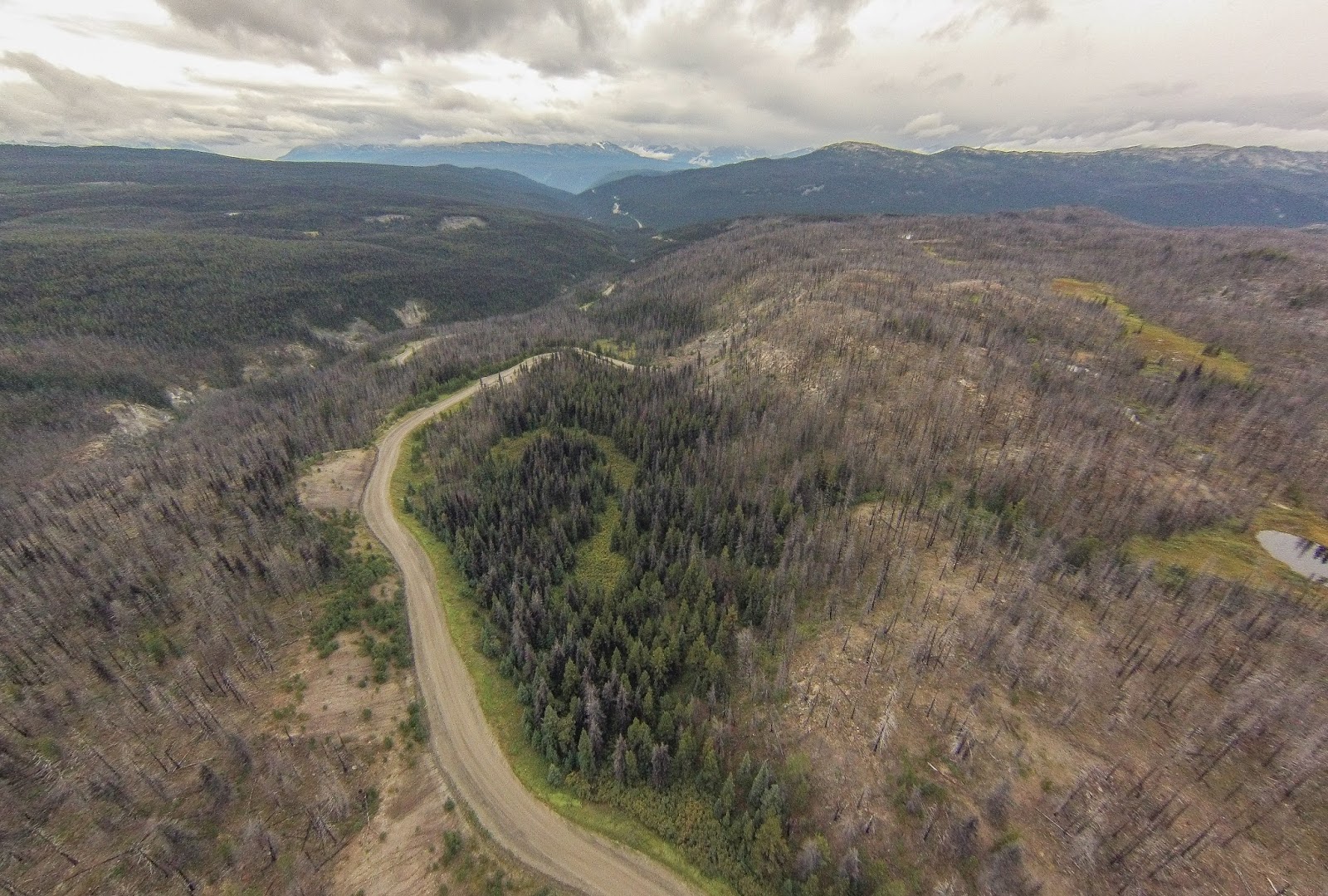
Drone shot of the road leading to Heckman Pass.

The Chilcotin Plateau and Bella Coola Valley is literally crawling with bears. One needs to keep their head on a swivel when in certain areas. I had a sow with a cub walk within 20 feet of me before realizing she was there. Vigilance, common sense, and as a last resort, bear spray, are some things you want to bring with you. I love to watch Grizzlies do what bears do in their natural surroundings. I would get on the river at daybreak and many days, not leave till dark. If you're into viewing & photographing bears it's pretty good here.

Sow with cub feeding on salmon.

Boar male.


Big Boar male who was missing his left ear.
There aren't many side roads you can take once over the pass and into the Bella Coola Valley. The ones that are there are more suited to a four-wheel drive, which the Chinook is not. Not being the sharpest tack in the box I attempted to take the Chinook a couple of places I shouldn't have. A road leading up to one of the waterfalls is about 15 miles in. As I'm sitting looking at the sign around the 12-mile mark I'm telling myself this is not a good idea. I even got out and walked it and as I'm walking back to the rig was telling myself not to try it. I didn't listen and got after it. I didn't make it. Halfway up one of the steeper sections things went south and I began to spin which brought me to a quick standstill. I ended up backing up for almost a mile before being able to turn around. Note to self..... a class B van, minus four-wheel drive, is not suited for off road travel. I'm going to end up turning the Chinook into a piece of junk if I keep taking it off-road. The backing up part was not fun.


Got a couple of drone shots near camp that night. Bella Coola River in the background.


Ended up spending four days in the valley before climbing back over the pass to the Chilcotin Plateau where I drove back into Choelquoit and Chilko Lake in Nemiah Valley. More bears, wildlife, and scenery. Heard wolves at night but no sightings.


I had planned to do a loop back in Nemiah Valley as I'd been in here before but the road I was looking for washed out and was impassable. Only way back out was the way I'd come in. Getting dark, I pulled into a wilderness lodge to inquire about another option and ended up staying the night. I met Hans and his girlfriend who were both from Switzerland. They cater to Europeans coming over looking for a rustic wilderness experience. A small area for camping, rustic cabins and a small community lodge/kitchen. Everything on solar power. He offers horseback trips into the backcountry along with boat tours of Chilko Lake and river. Was fun to stay overnight and have breakfast with the group the following morning. Hans was looking after a ranch on the Chilko River not far from his place and let me have access to see some more, you guessed it, Grizzlies.


Was another great "roam about" in a beautiful area. The area even puts a smile on Han's pig!


