Wednesday, April 20

Deeper into Baja - Part 13


Now being back on the road solo I figured I'd just keep working my way north and didn't really have any set plans.  I had considered going back through San Francisquito and up for another visit with Pancho south of Bahia de los Angeles. I had told Pancho I'd try and come back through his way when heading north to bring him some supplies.  He wanted a calendar, dog food and Tequila. Doesn't take much to keep Pancho and his friend happy!  To do this route again would require about 80 miles of off-road if I took the turn off to El Arco and then worked my way up to his place along the coast.  I ended up not doing it and kind of felt bad about it but I didn't make him any promises.  I just didn't feel like doing that shit road again to get to his place.  I opted instead to check out a little village up in the mountains called San Francisco de la Sierra. A few miles outside the village is the Cueva del Raton paintings.  I came upon this sign near the mouth of the cave area and was actually surprised to find it in English.  This place is pretty well off the beaten path and the last five miles getting into the village is rough.  After reading the sign I went in search of "the local representative" who could hook me up with a guide.


There isn't much here other than a church, some goat pens, few buildings and one small little store attached to someone's home. When you roll into the village you certainly don't see anything marked where the local representative would be hanging out awaiting your arrival.  I ran across one other gringo in the two days I was here. After roaming around I finally located someone who seemed to know what I was after and the negotiations began. After many attempts to understand each other I paid my $150 pesos and thought I understood to be back at the cave entrance tomorrow morning at 9 am.  I knew it was happening tomorrow but the exact time was still in question as well as the actual meeting place.  Holding up my 9 fingers, pointing in the direction of the cave and getting the "Si Senor" confirmed it.  I got back to the truck and decided to drive outside of the village a ways prior to setting up camp.  Had initially started to camp in a field next to the church but an aggressive dog altered those plans.  One thing you have to be a little vigilant of down here, especially with a dog the size of Petey, is aggressive strays.  Most of the strays are friendly but every once in awhile....a bad one can be encountered.  Petey wants to play with all of them and this particular one was not in the playing mood.  Luckily, no harm was done but I didn't want to constantly be wondering where he was at, so Petey and I loaded back up to find a more remote spot for the night.  This is a really beautiful area with big slot canyons and huge vast vistas.  I learned that you can also make arrangements for mule trips down into the remote canyons.  


Goat ranching is the only means of subsistence. In this terrain, there are no crops to be found.

Found a remote spot a few klicks from the village and had two visitors that night in camp.  Old guy comes along on foot out of the brush carrying wood which he gathers as cooking fuel.  He comes up and I finally figure out that he's trying to tell me that he would be my guide tomorrow. I guess the "local representative" let him know a gringo was in town and wanted to see the paintings.  How in the hell he knew where I was camped at, or if he just happened to stumble upon me, I don't know.  I'd gone quite a ways from the village to camp and he just shows up a few hours later.  He gathered some more wood near camp and then headed off down the road. 


I'd now met my guide but the next visitor in camp seemed to be a much more important figure in the village. He rode up into camp and after the obligatory "hola" was exchanged we just kind of stared at each other. He had zero English and I didn't have enough Spanish to do much of anything else. I pointed at the camera, got the head shake so I took the one picture.  After we stared at each other for awhile he simply rode off.  Probably mumbling to himself.....another dumb ass gringo! 


Another visitor to camp.

Petey and I greeted our final visitor to camp later that night.  A beautiful full moon.

Following morning, I broke camp and drove back down to the caves.  Nine o'clock rolls around...no guide. Nine thirty...no guide.  Ten....no guide. Petey and I walk around to kill some time but I'm figuring I've been stiffed.  Was worth coming in here regardless as it's a beautiful area but just as I'm getting ready to load up here comes the old guy I'd met in camp.  He unlocks the gate.  I look around and that's it. Their guiding consists of unlocking the gate and then taking a siesta on a big flat rock. Old guy had to be well into his 80's and had walked about a mile or so from the village to let me in. Friendly old fella who got tipped for walking that far and taking a siesta. I think they utilize the caves to generate a little income for the village which is only fair.


If into rock art and cave paintings Baja is covered in them. Access requires some off-roading and hiking but well worth it.  I find it interesting to explore some of these sites and wonder what their way of life was at the time. Another area that we'd been to earlier in the trip was up in the mountains east of Mulege.  I didn't post them up earlier but since I'm on the cave painting theme thought I'd throw them in here. If in the Mulege area it's worth the effort to get to these as well.


 Ranch hand that guides you back in the canyon to view the paintings.
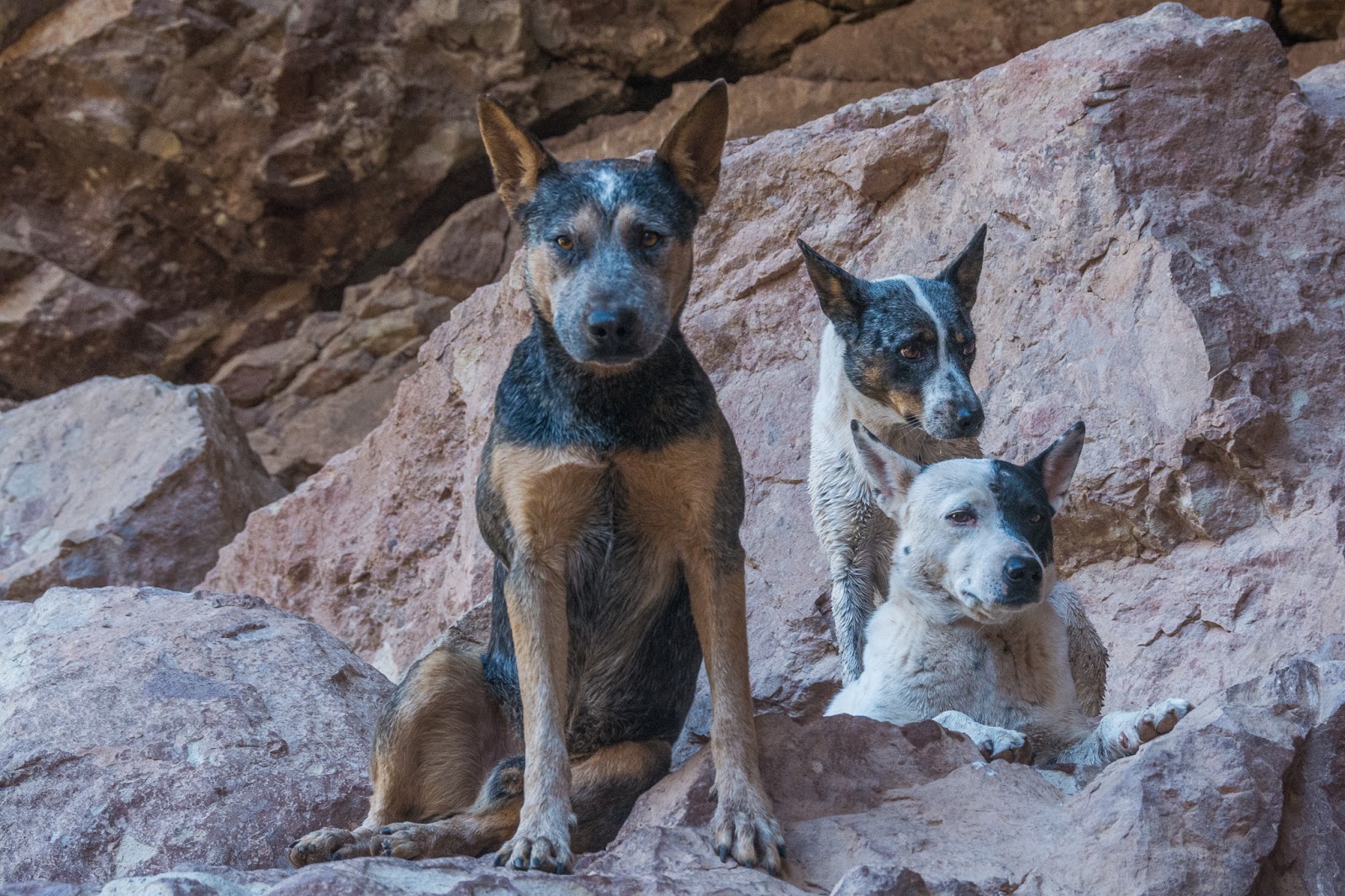
 Of course, I liked his dogs.

Hiking back out of the canyon.

One more post in Baja before crossing back over the border........


Saturday, April 16

Deeper into Baja - Part 12


Numerous times I've been asked to provide instructions on how to get to a certain place that I've been to,  camped at or where exactly a picture was taken.   I've even had some want to know if I would provide them with exact GPS coordinates so that their new-fangled machine can take them right to it. Depending on the wow factor of the area in question, they may or may not get directions but never GPS coordinates.  One, because I rarely use my GPS anymore and two, I have discovered that half the fun is figuring out how to get to some of the good spots the old-fashioned way. Following a blinking line on a GPS just kind of takes the adventure out of it for me. There is something about breaking out your well-worn map, standing alongside your rig with your map on the hood, stabbing your finger at a spot and thinking to yourself....this is where I want to go.   Directions in Baja are usually pretty vague depending on whether the information giver really wants you to find what you're looking for or not.  Turn left at the second rusty culvert past where the goat, brown goat not the white one, is tied out to the old yellow painted fridge between kilo marker 40 and 50.   You get the idea.  This next area we visited is one of those places in my book.  Is it some secret beach that very few gringos have ever camped at?  God no, far from it..... but it is still one of those places  not marked on the map with a big friggin "X marks the spot" or has a honking billboard out on the pavement with instructions to turn here.  You either need to know exactly where the turn off from the pavement is or "go explore" and find it yourself.  Now, some viewing this blog are going to instantly recognize the area once they view some pics.  Others may want to know....where is that? Once you discover places like this you instantly become stingy and don't want anyone else to know about it.  Of course, many already do, but you still feel that way to some degree.  Like it belongs to you and a few other hardy adventurous souls. Of course, that's bullshit, but one can dream. When "X marks the spot" and the billboard is erected the charm will be gone.   So until those things happen, I'm going to be selfish and keep my mouth shut. If you already know this area, you're lucky and I'm sure you hope to return one day to find it unchanged. Hopefully, you'll keep it to yourself or at a minimum.....give less than perfect directions if asked.  Here are my detailed instructions to find this spot....it's at the end of a dusty ass dirt road in Baja.  Good luck.

 Some silt beds on the way in.

Drive in.

This is the last area Wayne and I camped prior to departing ways.  I spent a week in this one spot and after I departed I think Wayne stayed at least another week before moving on.  

 This bay provides a great spot for sailboats to anchor up in. We had several different sailboats in the bay while we were there.  


Petey and I out for a late paddle. (photo by Wayne)


 Fish osprey and nest near camp.  A hike up the ridge behind camp and I was looking down into the nest from the cliffs above. Would have been some great pics if the nest would have been holding some chicks but I think I was a couple of weeks early.

 A lone wild burro near camp.

 Wayne's rig is under that dirt spray.  He was pulling someone out who was stuck on the beach.

The stuck party.

Speaking of parties. Our social event with the sailboat crowd. One of the skippers organized a "pot luck" and requested that we hold it our campsite.  

The party crowd with their transports to the beach. Some of this crowd had some nice sailboats. Interesting, diverse group of sailors. 

 Petey and I visiting a former acquaintance I ran into on the beach the first day we arrived.  Doug and Linda have been coming down to Baja for many years on their sailboat.  I had known them through business dealings back in Bend and hadn't seen them for years.  Was surprised to actually run into them down here.  It's a small world.

Doug and Linda had us out for dinner and adult beverages one evening.

 Doug & Linda aboard the "Que Linda".


Arno, another boater we met, invited Petey and I aboard while we were out paddle boarding one afternoon. 


Petey returning to camp.

 Drive back out to pavement and north towards the border. This poor fella hadn't been down long as the buzzards were just starting to circle. Pretty harsh environment in places down here.

Friday, April 15

Deeper into Baja - Part 11


Decisions, decisions.  Should I stay in the southern part of Baja for another few weeks or begin the slow crawl back to the north and return to the states?  I've mentioned it before in a previous post while I was in Alaska.  The urge to start picking up the pace once I reach the turn around point can take hold if I don't recognize it.  Not once on the drive down did I ask myself...when should I get back. Now that my compass direction had spun 180 degrees, the question lingered.  I reminded myself to slow back down and set about planning a few stops along the way to the border.  After leaving Todos Santos we simply pounded out the miles, backtracking over pavement we'd already done coming down, until reaching an area south of Loretto.   We had been told of a nice beach area not far from Loreto that was somewhat unknown, didn't get a lot of use and had some good camping.  Once again, after a few wrong turns, couple of dead ends, we eventually found a nice beach with just a couple of other campers.  We discovered at the end of the beach that with just a short blast of four wheeling through some soft sand the camping got even better and afforded us with a private spot.  


 Waynes first priority when setting up.....kitchen camp.


While in Cabo roaming around Costco munching on free samples I ended up buying a paddle board.  Go in for free samples and come out with an overpriced board!  Now that we were back on the calmer Sea of Cortez side it was time to break it out. (photo by Wayne)

Many small coves to explore along the coast.


Couple of small islands off the coast from camp where we paddled out to do some snorkeling and fishing. Wayne with a puffer fish


(photo by Wayne)

From one of the small bays along the coast, I took out and portaged overland to another small cove.  The hike and carry saved miles of paddling down the coastline. Wayne was out in the open ocean somewhere as the kayak can certainly handle longer distances and rougher water.  Explored this cove and then carried back across.  I paid for this little excursion the following day as I tweaked my back during the carry. The following morning I was so "stove up" I thought I'd eventually have to have the camper cut off from around me. It was touch and go. For everyone who understands the confinement factor of a Four Wheel Camper, you can relate to the trauma of de-bedding and exiting one in an invalid state.  It was ugly my friends! It was a herculean effort to simply get out of the rack, much less the camper.  The paddleboard received limited use over the next couple of days & when it did, post paddle rest was necessary! With some stretching, aspirin, beer & come to Jesus talk....I eventually recovered. I will say that the paddle board appears to be a nice option when overlanding.  It packs up small, is easily stored and can be set up in short order. On it, you can easily access some of the closer islands and remote coves along the coastline. Nice option when camped near "flat water".  I'm sure I'll end up using it often on future trips but may skip the longer overland portages.

Neighborhood buzzard waiting for the bad back to finish me off. 

Recuperation. Not only can you do some exploring on it but it also makes a nice nap platform for man and beast alike. (photo by Wayne)

 Just over the rise in this picture was a beautiful sandy beach.  Yea, I know. No pictures or it wasn't really there.

Ike and Wayne in camp. 

After a few nights we'd move on a little further north up the coastline. Our next camp proved to be a good one... I stayed for a full week.  Wayne, even longer, as this would be the point where we parted company. I would continue the northern exodus to the border while Wayne put down roots and I think ended up staying over two weeks in this one spot. More on this area in the next post......